Our Approach
Straughan Environmental has been contracted to provide Forest Management Plans (FMPs) for three large parks within Baltimore City: Herring Run Park, Cylburn Arboretum, and Druid Hill Park; As well as Natural Resource Inventories (NRIs) for seven smaller parks: Farring Baybrook Park, Fort Armistead Park, Moore’s Run Park, Keyes Field Park, Fort Holabird Park, Lakeland Park, and Morrell Park. The FMPs will provide a comprehensive presentation of existing forest conditions, analysis of forest sustainability (including threats, regenerative ability, etc.), as well as strategies and itemized management recommendations for rehabilitating and strengthening forested parkland health. FMPs and NRIs will also provide a technically accurate and accessible understanding of existing forest conditions and threats to sustaining forest health.
Straughan performed extensive field data collection at specific intervals to collect season specific field parameters. We created customized and organized survey forms uniquely for this project to allow field crews to quickly fill out forms for specific features and be prompted with questions relevant to their data collection effort. Additionally, FMP development includes analysis utilizing the latest version of an industry-tested application developed by the USDA Forest Service NED-3 (version 3.0.7.5, Twery and Thomasma 2021) designed for forest ecosystem management decision support by identifying management area specific goals for a forested area. NED-3 provides a rigorous and defensible tool for woodland management that allows for the development and assessment of existing and proposed conditions within forested areas.
A subsequent outcome of field investigations and data analysis is the development of management recommendations within the FMPs. This critical component of the FMPs is based on processing and mapping the field data to create data layers that are then overlaid with one another to extrapolate trends and patterns of urban forest conditions. Straughan will analyze data to identify the spectrum of forest quality across each FMP park.
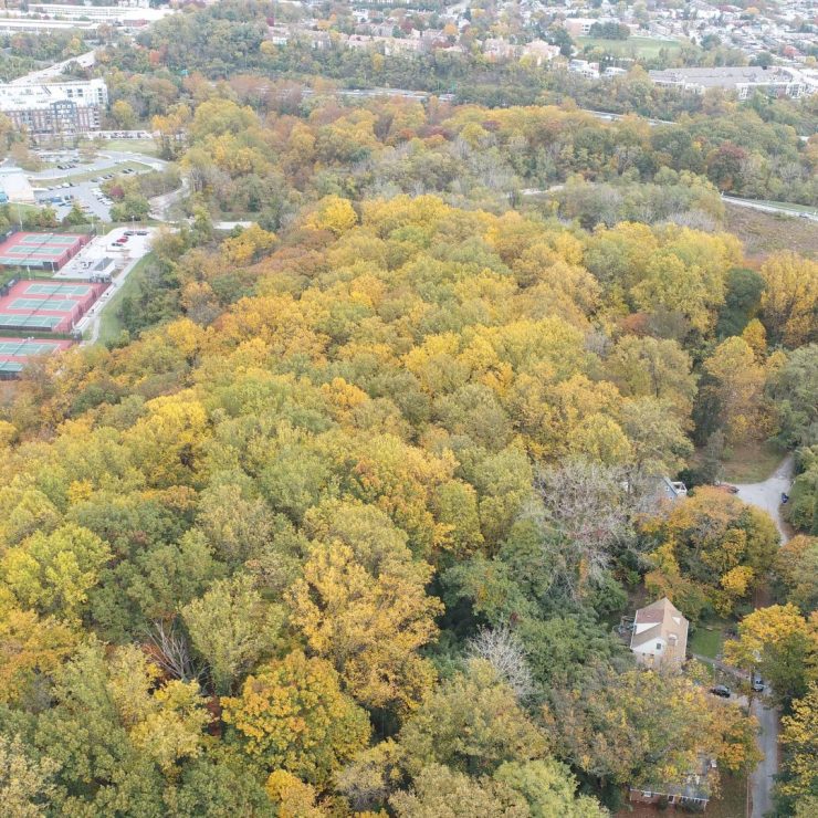
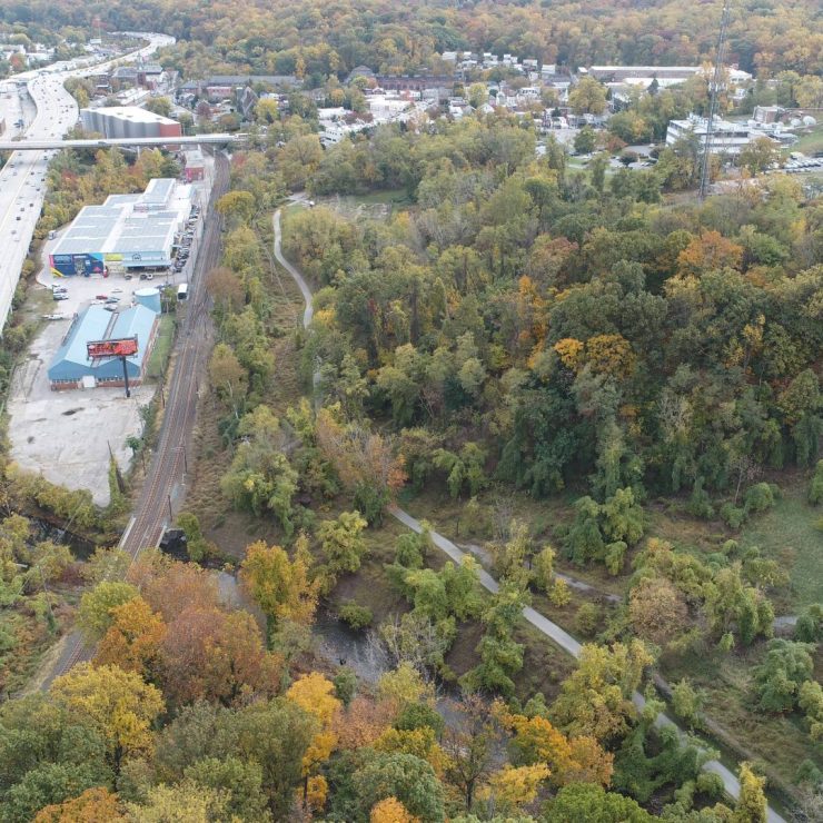
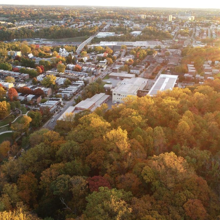
Straughan used a drone/unmanned aerial vehicle (UAV) to fly the three primary forests (Druid Hill, Cylburn Arboretum, and Herring Run), collecting both aerial photography and video. The aerial imagery captured was stitched together using drone post-processing software to provide a general assessment of site conditions and even ascertain general vegetation health. Flying a drone over these sites provides valuable imagery to on-the-ground field work. Low-level flights (vs. satellite imagery) make it easier to discern urban forest edges, and riparian areas (especially during leaf-off season). Imagery collected during drone flights will be used within the FMP analysis and development.