Our Approach
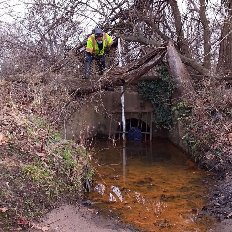
Straughan was selected for a competitive grant by the District Department of Energy & Environment (DOEE) to map historic streams and identify potential buried streams as suitable candidates. GIS was essential to every aspect of this project. A historic stream network was delineated through the georeferencing and digitization of historic mapping selected for surface streams. GIS input layers were used in conjunction with Python scripting to calculate local regression equations to determine base and storm flows at each of the more than 500 MS4 outfalls throughout the district. These flow rates were just one of several weighted inputs that went into a GIS-based suitability model built from Python to determine the top-rated sites for daylighting. These sites were field validated using a robust methodology combining both the Collector and Survey123 for ArcGIS applications. Finally, the story of this project and the history of stream burial in the District was highlighted through an ArcGIS StoryMap.
Straughan’s use of GIS technologies throughout this project provided a variety of efficiencies and benefits for DOEE. Using Python scripting for complicated equations and analyses means that input variables can easily be changed per client specifications and the entire process can be rerun automatically, saving hours of time. The use of Survey123 in field validation allows for the creation of custom report templates to store fieldwork results. Results can be exported directly into the template without the need for manual entry. Finally, the use of StoryMaps allowed us to seamlessly weave together a detailed and interactive story of the project, complete with pictures, map tours, and external links for users. Should DOEE move forward with any of the proposed daylighting sites, the StoryMap will be valuable in garnering public support and answering questions about how daylighting may work.