By: Phillip Capon, PE
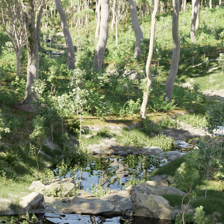
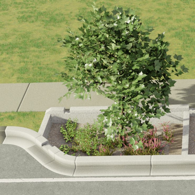
Design visualization, or rendering, is a combination of art and science, creating detailed and beautiful images of proposed engineering designs. These visualizations can show the design in an accessible way to a non-technical audience, help build support from community and funding partners, and allow stakeholders to better understand potential project trade-offs before a project begins construction. To create this imagery, a visualization artist takes the proposed engineering design and existing data from site surveys, public GIS sources, and site photographs and generates a three-dimensional model of the land project using 3D modeling software such as 3ds Max or Blender. The artist can then use a virtual camera to take photographs and videos simulating a walkthrough of the finished project. The finished pictures, or renderings, of the project will be photorealistic because the modeling software uses complex light simulations to trace how rays of light will bounce around the scene be absorbed by some surfaces and reflected by others.
Straughan has begun to put this technology to use, having developed renderings on several projects. On a current project with the District Department of Transportation, we developed a parametric 3D model of a proposed bioretention design where different input criteria could be entered to demonstrate how the design could be used in various location depending on the physical characteristics of the space. We have also begun working on reality capture, creating 3D scenes from drone imagery.
Can you spot which part of this photo is not real?
Stay tuned for Parts 2 and 3 of our 3D Rendering Series that will describe our endeavors in more detail!