By: Phillip Capon, PE
We are back with our final installment of our 3D rendering series. Let’s do a quick recap of what we covered for those of you who have not seen our other posts.
Back in October, we discussed visualizing designs with 3D rendering. At Straughan, we are starting to incorporate this more and more into our project work. On a current project with the District Department of Transportation, we developed a parametric 3D model of a proposed bioretention design where different input criteria could be entered to demonstrate how the design could be used in various location depending on the physical characteristics of the space.
We have also begun working on reality capture, creating 3D scenes from drone imagery, which led to our second topic in December — How we can use drones to help create our 3D renderings? This technology can be used across all of our service areas on a variety of tasks. For example, drone flights could capture monitoring data over several years to document vegetation growth or soil erosion. They can create detailed existing conditions models for concept designs that show basic dimensions, locations, and conditions of constraints such as manholes and pathways. Flyovers can be done during and post- construction to record as-built conditions and compare construction to the original plans.
Now, we are bringing the conversation back to what this means for our clients. How can we use 3D models to speed up and enhance our design process to provide our clients with more efficient and site sensitive projects?
3D models provide an extremely detailed look at how all the parts of a design fit together at once. This reveals conflicts between different standard details and parts that could be overlooked. By identifying these conflicts early in the design process, we are able to make the adjustments necessary to ensure for a successful end result.
Many standard details and regulations also require certain relationships between dimensions. Designers can use CAD and 3D modeling software like Blender to automatically generate all possible designs for certain standard details in a given site and then evaluate the different results for the best fit for a project. When we are able to see the various options in a quick and complete format like that which is provided through Blender, we can create a higher quality product more efficiently.
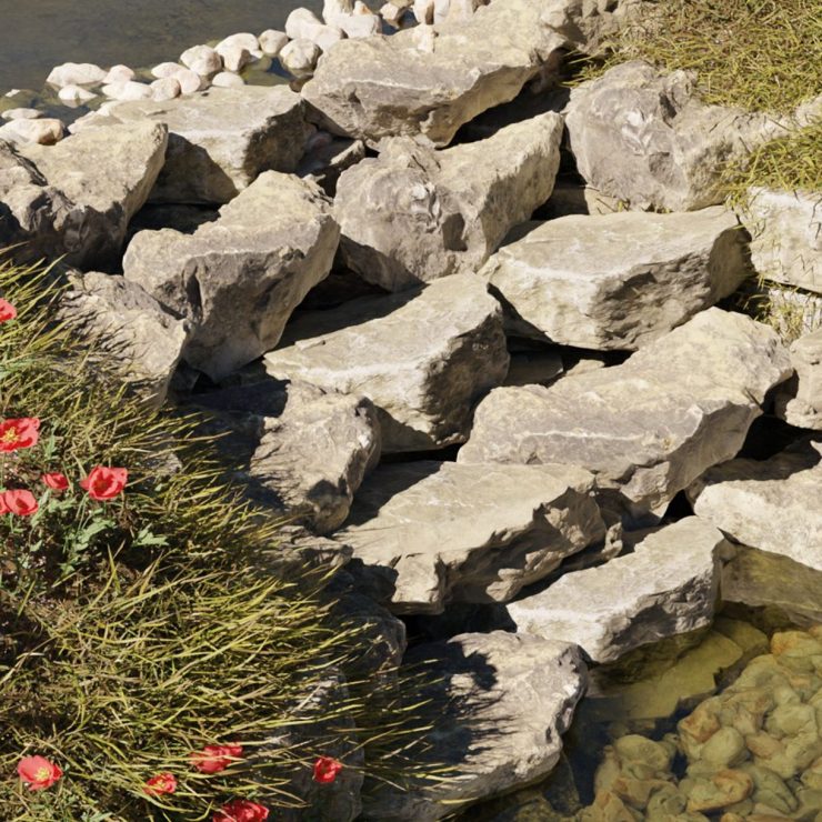
Any stream, shoreline, or stormwater structure that we iteratively design by varying the physical footprint and profile in CAD and then confirm if it meets the sizing requirements could be sped up with these 3D models. For example, step pool cascades, a rendering of one is shown in the image to the left, and riffles have standard design calculations that could be automated with a 3D model. The designer could then vary the slope and width of the structures directly in CAD and get real time feedback on whether the new size is stable. This could remove much of the time spent going back and forth between CAD and spreadsheets and let the designer quickly iterate to find the best fit for the landscape. Other ones could be bioswales, plunge pools, living shorelines, or floodplain restorations.
We would love the opportunity to bring our 3D renderings expertise to your next project, so reach out to us today to learn more!